"Earth Sciences": 10 Geological Systems Put Kuwait on the Global Map - Sarmad
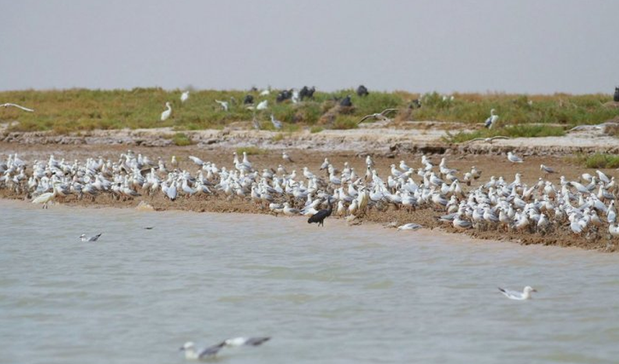
The president of the Kuwait Society for Earth Sciences confirmed that Kuwait hosts 10 unique geological systems and called for the establishment of a Geological Survey Authority.
Translated by Qiyas from سرمد — Original source
The Kuwait Society for Earth Sciences announced on Tuesday that Kuwait hosts ten unique geological systems, forming an open-air natural museum that places the country on the global map.
Dr. Mubarak Al-Hajjar, president of the society, told the Kuwait News Agency (KUNA) on the occasion of World Geodiversity Day, observed annually on October 6 as designated by the United Nations Educational, Scientific and Cultural Organization (UNESCO), that the local geological heritage includes coastal and desert landscapes that tell the story of the climatic and tectonic changes the region has undergone over millions of years.
Dr. Al-Hajjar noted that the first system on this list comprises Kuwait’s nine islands. He explained that Warbah and Bubiyan islands possess a sedimentary environment distinct from the other Kuwaiti islands due to their proximity to the Shatt al-Arab and freshwater sources, as well as their rich fungal and biological diversity.
He added that large parts of these two islands are included in local and international environmental protection lists in the country, forming the core of the Al-Mubarakiya Marine Nature Reserve. The other seven islands—Failaka, Kubbar, Umm Al-Maradim, Masikan, Auhah, Umm Al-Naml, and Qaruh—hold significant ecological and economic value, in addition to their historical and heritage importance.
Regarding the second system, he stated it is represented by the Kuwait Bay, which is the world’s second-largest natural nursery for fish and shrimp, immediately after the Gulf of Mexico. The third system consists of Kuwait’s coastlines, with a coastal strip stretching approximately 325 kilometers, featuring sedimentary environments ranging from mudflats to coral reef shores.
He mentioned that the fourth system comprises coastal and continental sabkhas, covering nearly 7 percent of the country’s total area. He pointed out that the Kuwaiti coastline, extending for hundreds of kilometers, is characterized by its gentle slope, which has led to the formation of unique geomorphological phenomena associated with tidal movements.
Al-Hajjar stated that the Jaleez Al-Zour area constitutes the fifth system, a region of great geological richness. The sixth system is occupied by the Sabiya area due to its natural and geological significance, as well as its archaeological value as the site of the oldest human settlements in the Arabian Gulf, dating back to the Ubaid period (the fifth millennium BC).
He explained that Sabiya was selected as the core of the “Kuwait Geopark” project, the country’s first open geological park, due to its distinctive dry rocky nature, unique topography, and formations that resemble the surface of the planet Mars.
Dr. Al-Hajjar said the seventh system pertains to the hills of Dhar Al-Adan, Burqan, Warah, and Al-Qurain, which represent the most prominent topographical and structural features in the southern part of the country. These are isolated hills formed by erosion and weathering processes.
He noted that the eighth system is represented by the Ahmadi Quarry, a unique geological window and one of the most important exposed sites in the country, distinguished scientifically for hosting the oldest exposed rock units on the surface, specifically the Dammam Formation.
He added that Wadi Al-Batin occupies the ninth system, forming a massive geological landmark and a natural extension of Wadi Al-Rummah in the Arabian Peninsula. It was formed over thousands of years by massive water flows during rainy periods in the Pleistocene epoch.
He added that the country’s northern and southern deserts constitute the tenth system, noting that the geological nature of each differs from the other. He explained that the northern desert is characterized by rocky soil, in contrast to the southern desert, whose rocks are predominantly sandy.
Al-Hajeri praised the efforts of state agencies in preserving the country’s geological landmarks and highlighting the distinctive features of its geological systems. He reiterated the Association’s proposal to establish a Geological Survey Authority to serve as an umbrella for geological and research activities.