Omani authorities confirm continued efforts to deal with a stranded oil tanker to mitigate environmental risks - Sarmad
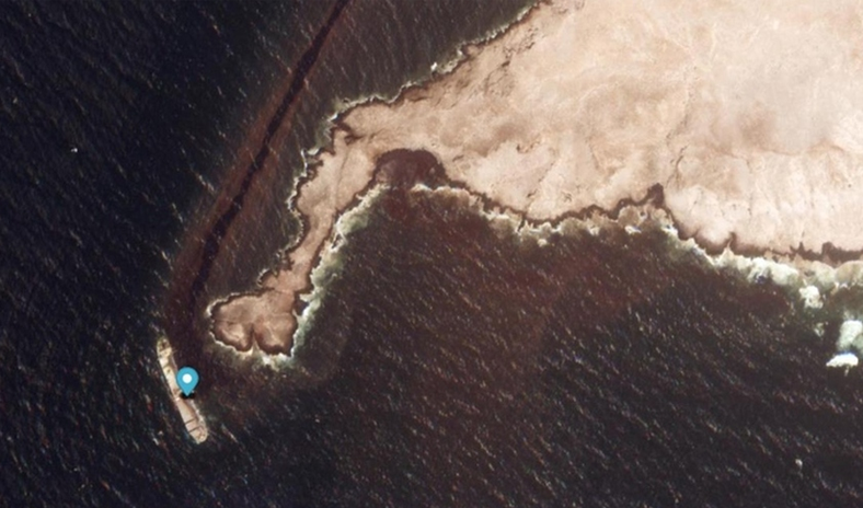
(Oman) The Environment Authority and the Ministry of Transport, Communications and Information Technology of the Sultanate of Oman are continuing their efforts, in coordination with relevant authorities, to address the grounding of the vessel “Caroline Bezengi” off the Hallaniyat Islands in the Dhofar Governorate. This response involves a comprehensive national effort combining technical remediation of the spill and vessel stabilization, with continuous environmental monitoring, observation, and assessment, to mitigate the risks of the incident, protect the marine environment, and ensure navigational safety.
The Environment Authority confirmed that it is monitoring the incident through an integrated system for environmental observation, monitoring, and assessment, involving specialized national technical teams and utilizing modern monitoring tools, satellite imagery, environmental models, and field surveys. This approach enables continuous evaluation of the environmental situation, tracking the movement and spread of oil pollution, and identifying priority areas for response and protection operations.
It noted that the environmental response to the incident is based on updated scientific and technical data and actual monitoring results, with ongoing assessment of potential risks to the marine environment, coastal areas, and ecologically sensitive habitats.
The Authority clarified that the latest monitoring and technical analysis, including satellite image analysis, indicated the continued presence of oil pollution in the marine area associated with the incident. A slick covering approximately 390 square kilometers was detected, extending northeast from the Hallaniyat Islands toward the mainland coast, with its closest point reaching a distance of about 7 kilometers from the shore.
Observations and image analysis showed that the slick continues to move along a similar trajectory, with an observed extent of approximately 449 kilometers along the path.
According to current assessment and modeling results, the slick is generally moving northeast, with projections indicating it could advance by about 121 kilometers over the next 48 hours, based on prevailing marine and weather conditions at the time the model was prepared. The Authority emphasized that this projection represents a scientific forecast rather than actual observation, and that environmental models are subject to changes in wind, currents, and marine conditions.
Analysis results indicated that the thickest parts of the pollution may be heading toward the entrances of Ras Madrakah, necessitating continued intensive monitoring of priority marine and coastal areas. The Authority stressed that the observed slick area of approximately 390 square kilometers does not represent the quantity of spilled oil, but rather the geographical area where pollution was detected during the latest monitoring and analysis operation.
It explained that the relationship between the slick’s area and the volume of oil cannot be determined directly, as it depends on several technical factors, including oil layer thickness, oil characteristics, degree of dispersion, marine current movements, wind direction and speed, waves, and overall marine conditions.
The Authority noted that the area, shape, and location of the slick are subject to change from one observation to another due to natural movement, spread, and dispersion. Therefore, the reported figure should be treated as a technical reading associated with the time of observation, rather than a fixed value.
Regarding the ongoing pollution and its monitoring, the Environment Authority noted that current monitoring results indicate that pollution is still visible on the sea surface, continuing to move, change shape, and spread under the influence of marine and weather conditions. The Authority’s specialized teams continue to monitor changes in the oil slick’s area, location, and direction of movement, comparing successive monitoring results to determine the rate of change and spread direction, thereby supporting timely decision-making. Data are continuously analyzed to determine whether the observed slicks represent continuous accumulations or scattered patches resulting from dispersion and spreading processes.