A window between the clouds reveals a rare lava lake near the Antarctic continent
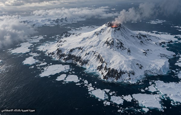
In one of the most remote regions on Earth, the Landsat 8 satellite captured a rare view of Mount Michael, a volcanic peak rising from the ice on Saunders Island, part of the South Sandwich Islands in the southern Atlantic Ocean.
The image was taken on August 24, as clouds cleared near the end of the southern winter.
Scientists at NASA’s Earth Observatory added infrared data to the natural-color image, rendered in red, revealing a thermal signature emanating from a persistent lava lake within the summit crater.
A small volcanic plume and dark patches above the snow were also visible, indicating ongoing activity.
The mountain reaches an elevation of approximately 843 meters. Its isolation and frequently cloudy weather make field observation extremely difficult, so scientists rely primarily on satellite imagery to monitor its changes.
A scientific study published in 2019 analyzed images captured by Landsat and Sentinel-2 satellites, as well as data from the ASTER instrument, over a period of nearly 30 years, providing evidence of a lava lake within the crater. The Smithsonian Institution’s Global Volcanism Program confirms that the mountain’s activity includes gas emissions, the presence of a lava lake, and sporadic eruptions that can produce ash columns.
Persistent lava lakes are a rare global phenomenon, and thermal signatures allow researchers to monitor this volcano even when it is obscured by clouds and snow.